Tel
+86 17335721002
email
support@bingce.com
Business Hours
Monday to Friday, 9:00 AM to 6:00 PM, with holidays off.(UTC+08:00)
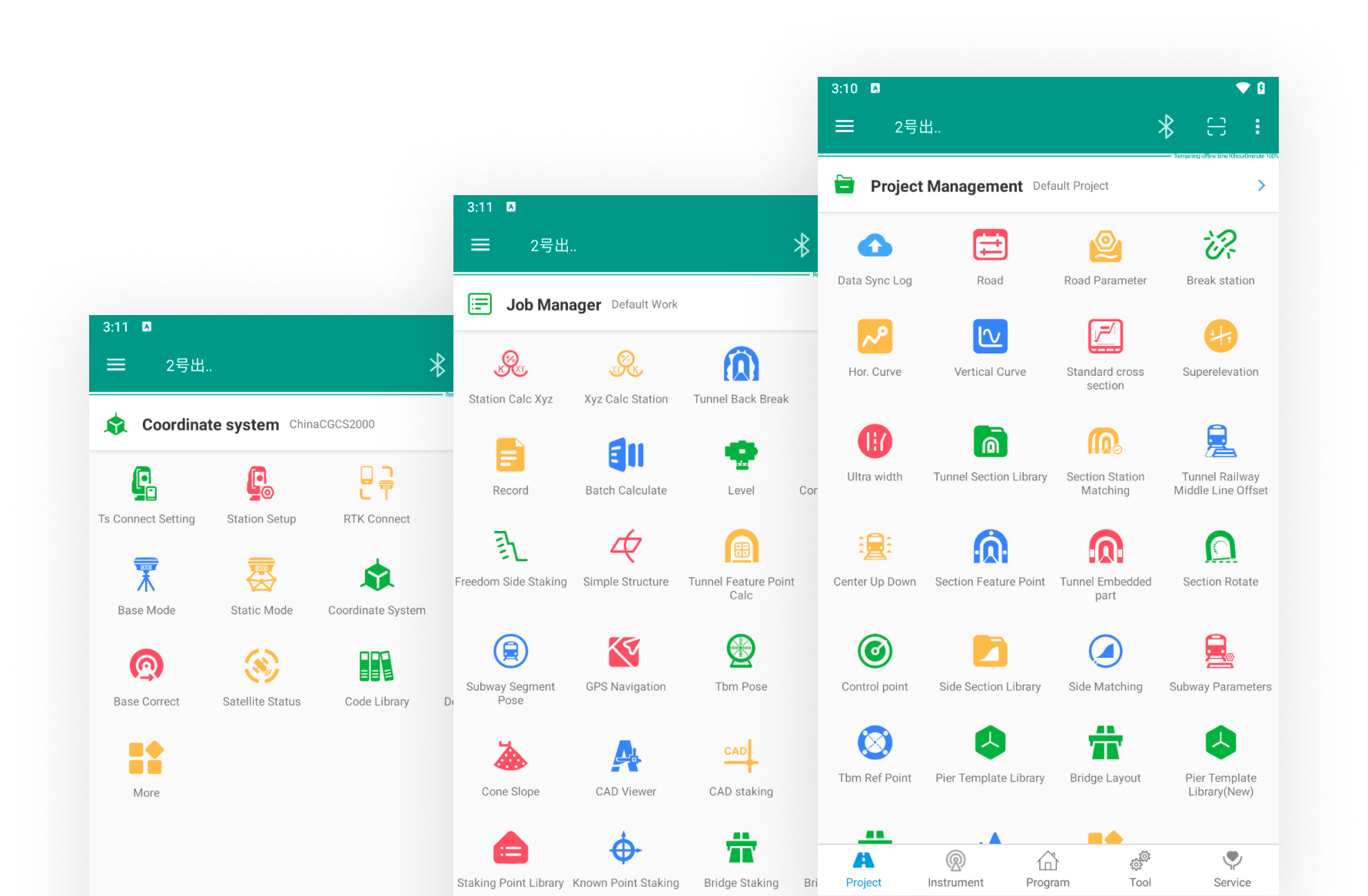
Survey Ape is a surveying application that runs on smart mobile devices and is mainly used for roads, bridges, railways, tunnels, subways, municipalities, and other projects. It can connect to instruments wirelessly and receive measurement data in real time, eliminating the trouble of manual input and avoiding problems caused by input errors. Using the powerful processing capabilities of the mobile phone, the results can be calculated instantly, coupled with an intuitive graphical display. It features accurate calculations, ease of use, efficiency, intelligence, and convenience.
PS: Non-Chinese users, please download here!
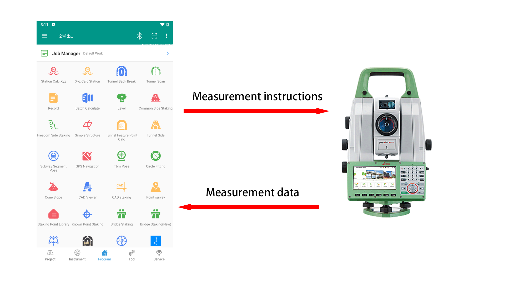
Connect the total station and GNSS receiver to receive measurement data in real time. After being connected, it can replace the original factory program for setting out. This saves you the trouble of manual typing and avoid problems caused by typing errors. Currently supported total station brands include: Leica, Topcon, South, Sokkia, Pentax, GeoMax, Nikon, etc. Supported GNSS receiver brands include CHCNAV, South, HI-Target ,Alpha,UniStrong,STONEX,etc.
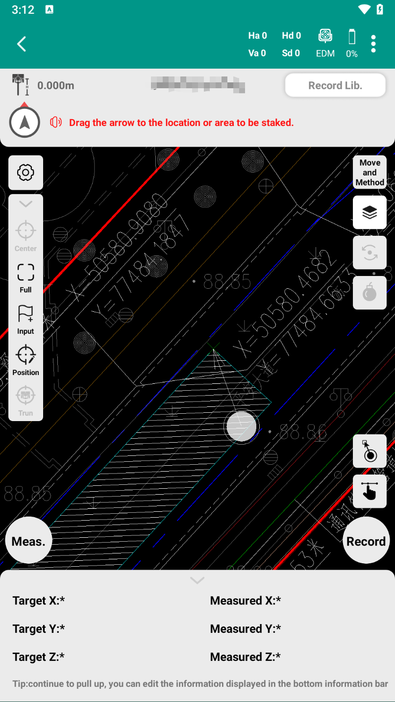
Open the local CAD drawing file on the mobile phone and select any point or line segment for staking.
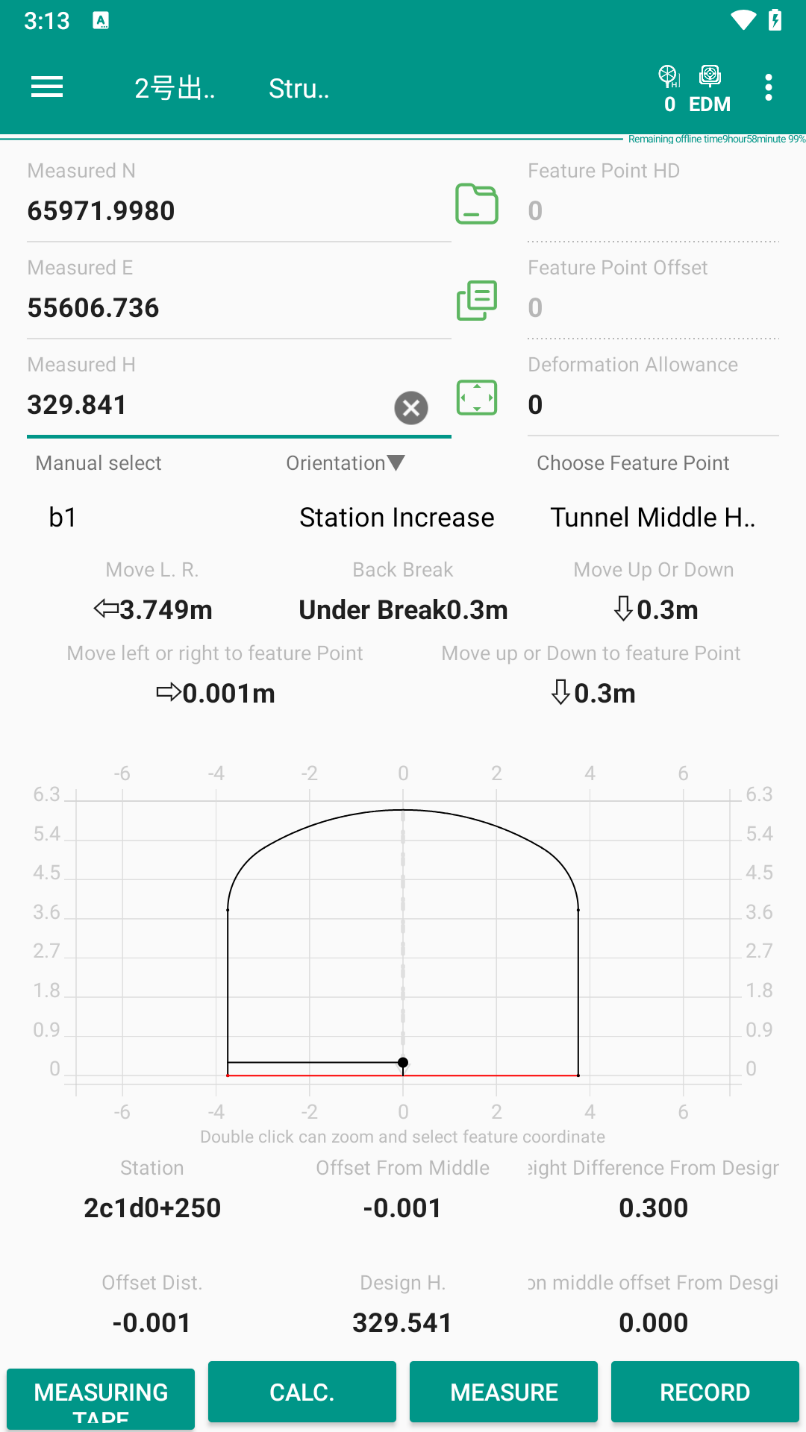
It provides integrated solutions for tunnel engineering section measurement, excavation contour staking, section scanning and acceptance, batch data processing, and graphics generation.
 安卓:安卓8及以上系统
 iOS:iOS15及以上系统
 鸿蒙:支持
鸿蒙:支持